
General Information
| Completion: | 1909 |
|---|---|
| Status: | in use |
Project Type
| Structure: |
Segmental arch bridge |
|---|---|
| Function / usage: |
Road bridge |
| Material: |
Masonry bridge Structurae Plus/Pro - Subscribe Now! |
Location
| Location: |
Wrightstown, Brown County, Wisconsin, USA |
|---|---|
| Location description: |
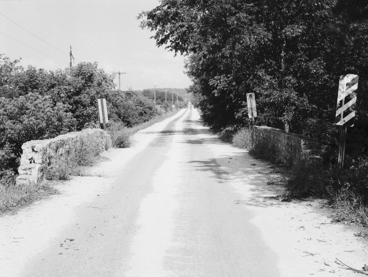
Spanning the East River, on Mallard Road, 4 miles northwest of Greenleaf Village, Wrightstown, Brown County, Wisconsin |
| Coordinates: | 44° 20' 8.05" N 88° 6' 42.98" W |
Technical Information
Dimensions
| span lengths | 2 x 5.49 m | |
| number of spans | 2 |
Materials
| arches |
limestone
|
|---|---|
| pier |
limestone
|
Written historical and descriptive data (HAER WI-43)
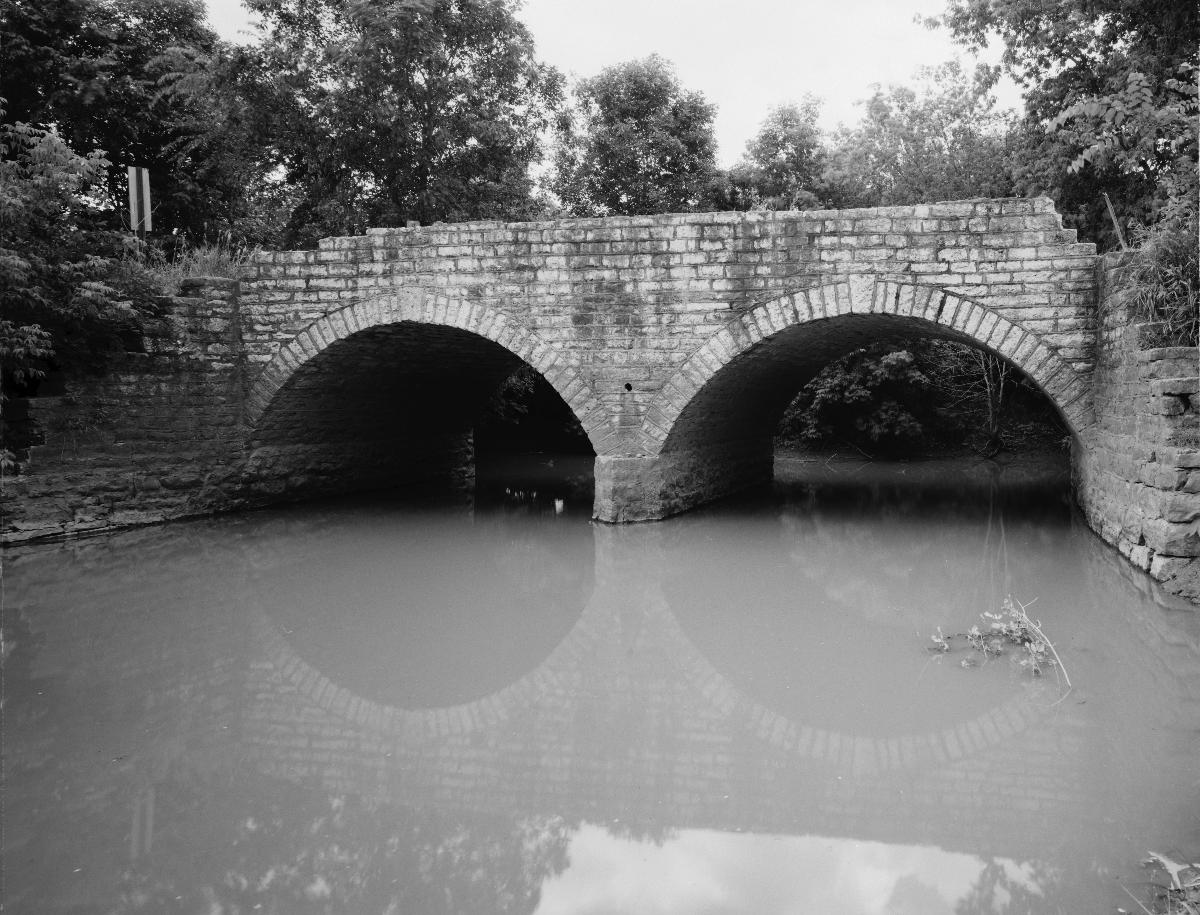
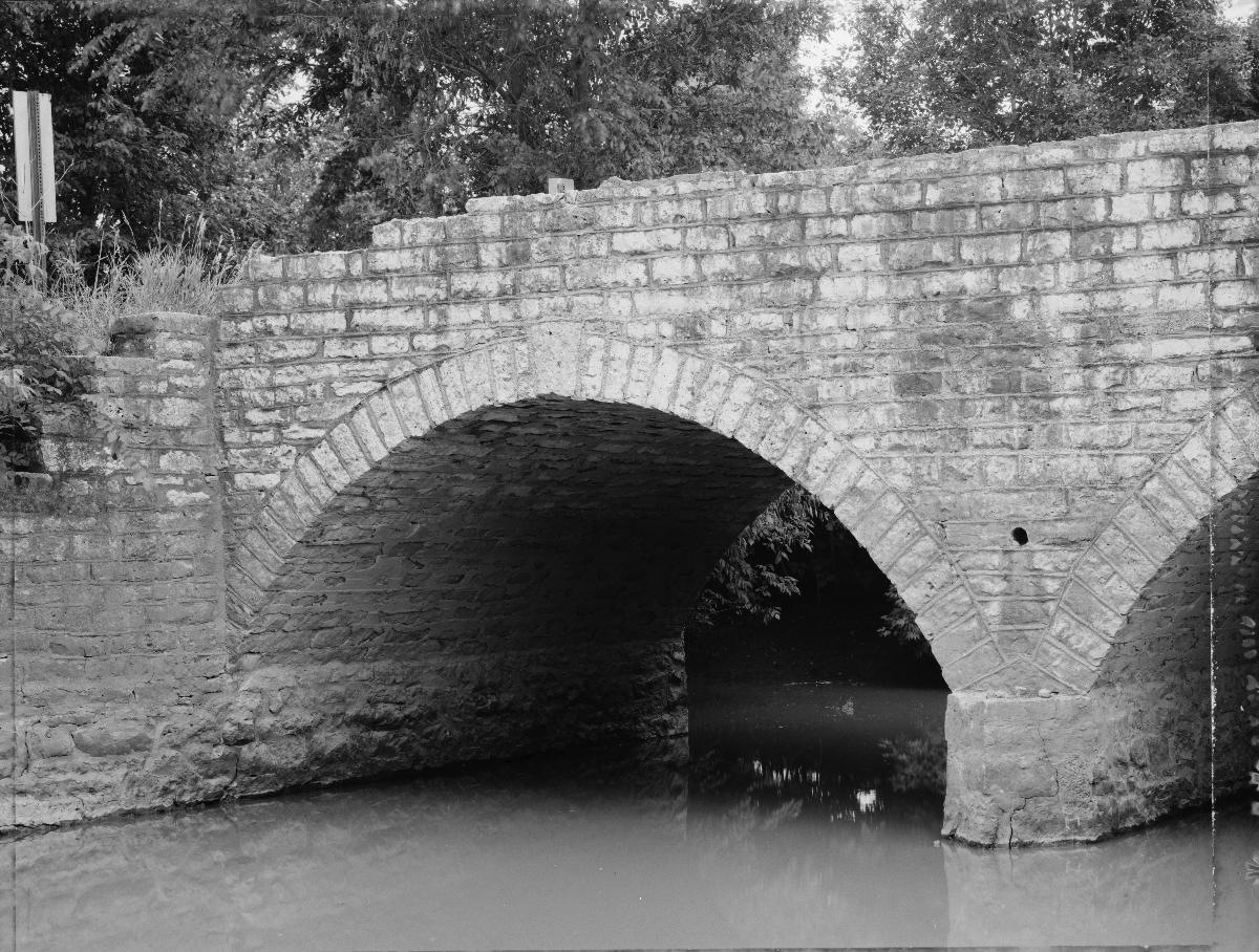
The Wrightstown Bridge is a well-preserved example of a stone arch bridge. Its elongated keystones and coursed rubble masonry are unusual features to find among rural stone arch bridges. Such ornamentation is general reserved for railroad and municipal structures.
Architectural Information
| Style: | Stone arch |
| Material of Construction | Rock-faced, coursed-rubble limestone |
| Shape and Dimensions: | Two stone arches; overall dimensions, 40x19 feet; segmental arches rise 6 feet over spans of 18 feet; arches spring 2 feet above waterline. |
| Exterior Features: | Elongated keystones over arches Perpendicular wing walls on north elevation Flared wing walls on south elevation Stone railings 28 inches in height Triangular cutwaters on both faces of the pier |
Source: Historic American Engineering Record, HAER WI-43, Written historical and descriptive data, compiled by Lola Bennett, Wisconsin Historic Bridges Recording Project
(Summer 1987)
Participants
Currently there is no information available about persons or companies having participated in this project.
Relevant Web Sites

- About this
data sheet - Structure-ID
20072439 - Published on:
16/01/2017 - Last updated on:
09/06/2017
Structurae cooperates with


