

General Information
| Name in local language: | Pont de Tonnay-Charente |
|---|---|
| Beginning of works: | 17 February 1841 |
| Completion: | 21 April 1842 |
| Duration of works: | 11 months |
| Status: | demolished (1934) |
Project Type
| Structure: |
Three-span cable-stayed bridge |
|---|---|
| Function / usage: |
Road bridge |
| Material: |
Structurae Plus/Pro - Subscribe Now! |
| Plan view: |
Structurae Plus/Pro - Subscribe Now! |
Location
| Location: |
Tonnay-Charente, Charente-Maritime (17), Nouvelle-Aquitaine, France Saint-Hippolyte, Charente-Maritime (17), Nouvelle-Aquitaine, France |
|---|---|
| Crossed: |
|
| Replaced by: |
Tonnay-Charente Bridge (1935)
|
| Coordinates: | 45° 56' 24" N 0° 53' 9" W |
Technical Information
Dimensions
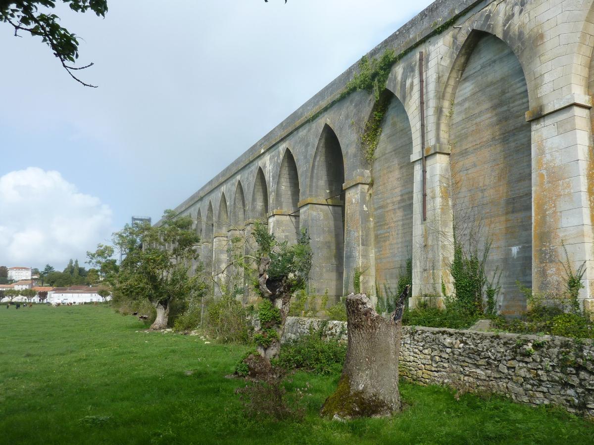
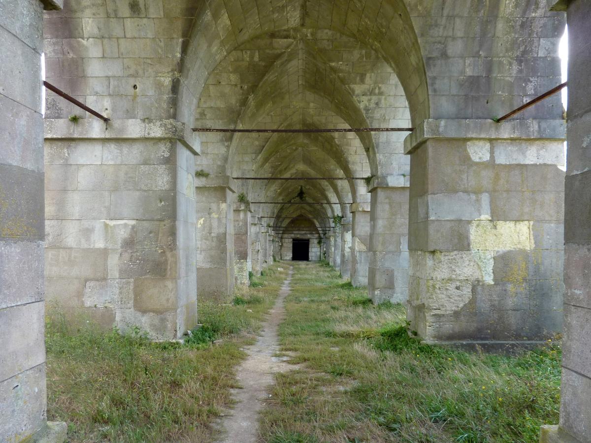
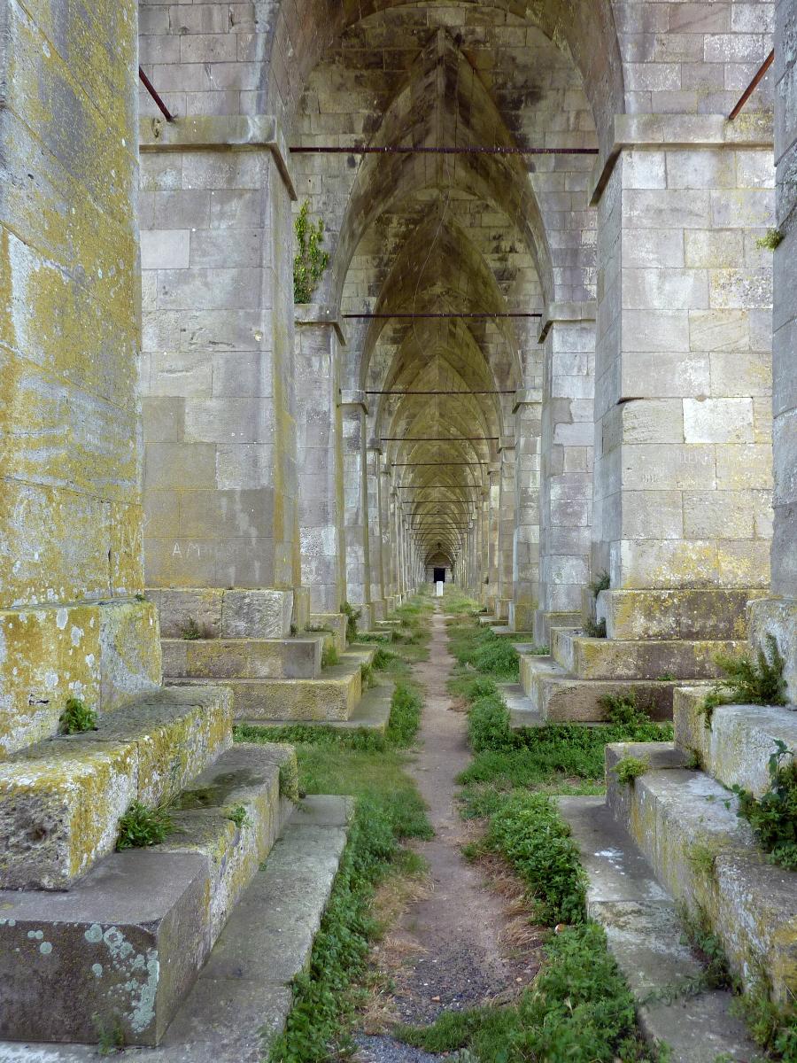
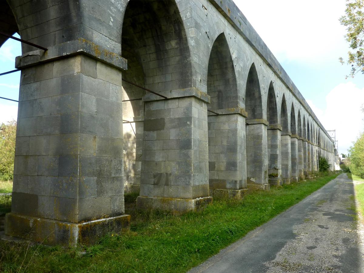
| total length | 623 m | |
| vertical navigation clearance | 22 m | |
| approach viaduct | ||
|---|---|---|
| total length | 416 m | |
| main bridge | ||
| main span | 90 m | |
| total length | 204 m | |
Materials
| piers |
masonry
|
|---|---|
| approach viaducts |
masonry
|
| deck flooring |
timber
|
Participants
Initial construction
- Louis Dor (chief engineer)
Engineering
- J. Masquelez (engineer)
Construction
Repairs (1884)
Engineering
- Ferdinand Arnodin (designer)
Relevant Web Sites
There currently are no relevant websites listed.
- About this
data sheet - Structure-ID
20087607 - Published on:
09/12/2023 - Last updated on:
09/12/2023
Structurae cooperates with


