
General Information
| Completion: | 1910 |
|---|---|
| Status: | in use |
Project Type
| Function / usage: |
Hydroelectric dam / plant |
|---|
Location
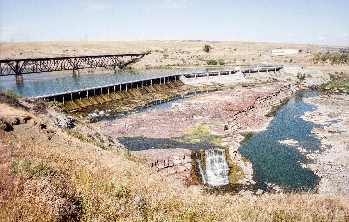
| Location: |
Great Falls, Cascade County, Montana, USA |
|---|---|
| Impounds: |
|
| Next to: |
Rainbow Rail Bridge
|
| Coordinates: | 47° 32' 5" N 111° 12' 17" W |
Technical Information
There currently is no technical data available.
Excerpt from Wikipedia
Rainbow Dam is a hydroelectric dam on the Missouri River, 29 feet (8.8 m) high and 1,055 feet (322 m) long, located six miles northeast of Great Falls in the U.S. state of Montana. The dam is named for the downstream Rainbow Falls, a 45 ft (14 m) waterfall that is the third of the five Great Falls of the Missouri. Built in 1910, the dam furnishes water to an eight-unit hydroelectric plant with a capacity of 36 megawatts. As the dam's power plant is located over a half-mile downstream, the flow of water over Rainbow Falls and downstream Crooked Falls is significantly reduced during the dry season. The water from the penstocks re-enters the river a few hundred yards east of Crooked Falls. Montana Power Company acquired the dam when it was founded in 1912, PPL Corporation purchased it in 1997 and sold it to NorthWestern Corporation in 2014.
Text imported from Wikipedia article "Rainbow Dam" and modified on 23 July 2019 under the CC-BY-SA 3.0 license.
Participants
Currently there is no information available about persons or companies having participated in this project.
Relevant Web Sites

- About this
data sheet - Structure-ID
20030447 - Published on:
22/08/2007 - Last updated on:
01/06/2023
Structurae cooperates with


