
General Information
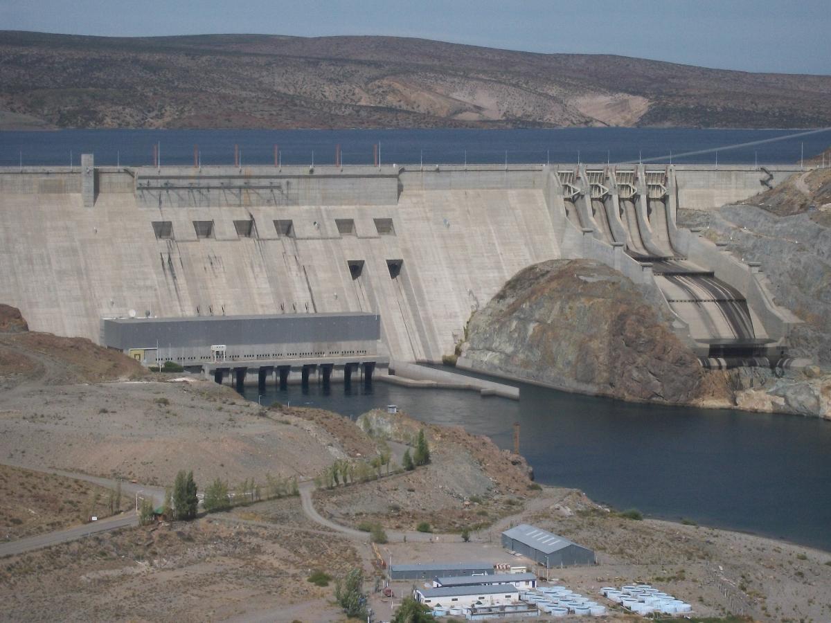
| Name in local language: | Embalse de Piedra del Águila |
|---|---|
| Beginning of works: | 1988 |
| Completion: | 1992 |
| Status: | in use |
Project Type
| Structure: |
Gravity dam |
|---|---|
| Function / usage: |
Hydroelectric dam / plant |
| Material: |
Concrete dam |
Location
| Location: |
Piedra del Aguila, Neuquén, Argentina |
|---|---|
| Coordinates: | 40° 11' 24.11" S 69° 59' 29.64" W |
Technical Information
Dimensions
| height | 180 m | |
| retained water volume | 12 600 m³ | |
| crest length | 800 m |
Materials
| dam structure |
concrete
|
|---|
Excerpt from Wikipedia
The Piedra del Águila Dam (in Spanish, Embalse Piedra del Águila) is the second of five dams on the Limay River in northwestern Argentine Patagonia (the Comahue region) and 590 metres (1,940 ft) above mean sea level, downstream from the confluence of the Limay and the Collón Curá River. It was inaugurated in 1993.
The dam is used for the generation of hydroelectricity and the regulation of the flow of the river. Ist reservoir has an area of 292 square kilometres (113 sq mi), a mean depth of 41.3 metres (135 ft) (maximum 120 metres (390 ft)), and a volume of 12,600 million cubic metres (10,200,000 acre⋅ft).
Text imported from Wikipedia article "Piedra del %C3%81guila Dam"
and modified on 23 July 2019 under the CC-BY-SA 3.0 license.
Participants
Owner
Client
General contractor
Subcontractor

Relevant Web Sites


Relevant Publications
- (1993): L'informatique sur un chantier d'injection de barrage Piedra del Aquila (Argentine). In: Travaux, n. 683 (January 1993), pp. 26-32.
- About this
data sheet - Structure-ID
20007406 - Published on:
03/01/2003 - Last updated on:
01/04/2022
Structurae cooperates with


