
General Information
| Completion: | 1880 |
|---|---|
| Status: | out of service |
Project Type
| Structure: |
Covered bridge Through truss bridge Multiple Kingpost truss bridge |
|---|---|
| Support conditions: |
for registered users |
| Function / usage: |
Road bridge |
| Material: |
Timber bridge |
| Plan view: |
Structurae Plus/Pro - Subscribe Now! |
Awards and Distinctions
| 1976 |
for registered users |
|---|
Location
| Location: |
Greenup County, Kentucky, USA |
|---|---|
| Coordinates: | 38° 25' 53.36" N 82° 53' 42.46" W |
Technical Information
Dimensions
| total length | ca. 57.91 m |
Materials
| truss |
wood
|
|---|
Excerpt from Wikipedia
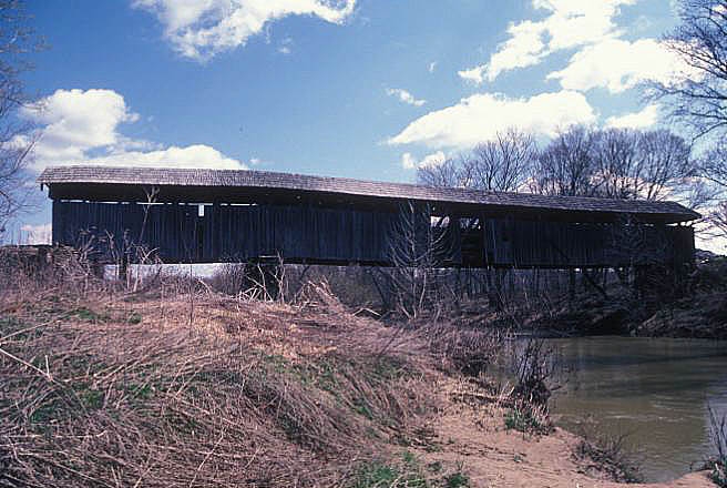
Oldtown Covered Bridge, near Oldtown, Kentucky, was listed on the National Register of Historic Places in 1976.
It is located east of Kentucky Route 1, south of Oldtown. It brings Frazer Branch Road 750 over the Little Sandy River. It is a two-span Burr truss bridge.
Text imported from Wikipedia article "Oldtown Covered Bridge"
and modified on 15 November 2021 according to the CC-BY-SA 3.0 license.
Participants
Currently there is no information available about persons or companies having participated in this project.
Relevant Web Sites

- About this
data sheet - Structure-ID
20006441 - Published on:
19/10/2002 - Last updated on:
13/11/2021
Structurae cooperates with


