
General Information
Project Type
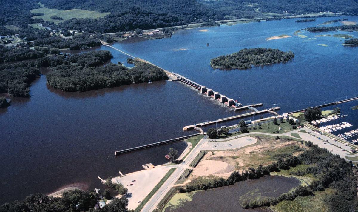
| Structure: |
Mobile barrage |
|---|---|
| Function / usage: |
Lock |
| Material: |
Concrete dam |
Location
| Location: |
Trempealeau, Trempealeau County, Wisconsin, USA Winona County, Minnesota, USA |
|---|---|
| Impounds: |
|
| Coordinates: | 43° 59' 46.80" N 91° 26' 29.18" W |
Technical Information
Dimensions
| dam structure | ||
|---|---|---|
| length of movable section | 272.2 m | |
| lock | ||
| width | 33.5 m | |
| length | 182.9 m | |
Excerpt from Wikipedia
Lock and Dam No. 6 is a lock and dam located near Trempealeau, Wisconsin on the Upper Mississippi River near river mile 714.1. It was constructed and placed in operation in June 1936. The last major rehabilitation was from 1989 to 1999. The dam consists of 893 feet (272.2 m) long concrete structure with five roller gates and 10 tainter gates. Its earth embankment is 2,600 feet (792.5 m)long and the concrete overflow spillway is 1,000 feet (304.8 m) long. The lock is 110 feet (33.5 m) wide by 600 feet (182.9 m) long. The lock and dam are owned and operated by the St. Paul District of the United States Army Corps of Engineers-Mississippi Valley Division.
Text imported from Wikipedia article "Lock and Dam No. 6" and modified on 23 July 2019 under the CC-BY-SA 3.0 license.
Participants
Currently there is no information available about persons or companies having participated in this project.
Relevant Web Sites

- About this
data sheet - Structure-ID
20030604 - Published on:
24/08/2007 - Last updated on:
02/05/2017
Structurae cooperates with


