
General Information
| Completion: | 8 September 1937 |
|---|---|
| Status: | in use |
Project Type
| Structure: |
Roller drum gate barrage Tainter gate barrage |
|---|---|
| Function / usage: |
Lock |
Location
| Location: |
Gladstone, Henderson County, Illinois, USA |
|---|---|
| Impounds: |
|
| Coordinates: | 40° 53' 1.06" N 91° 1' 34.44" W |
Technical Information
Dimensions
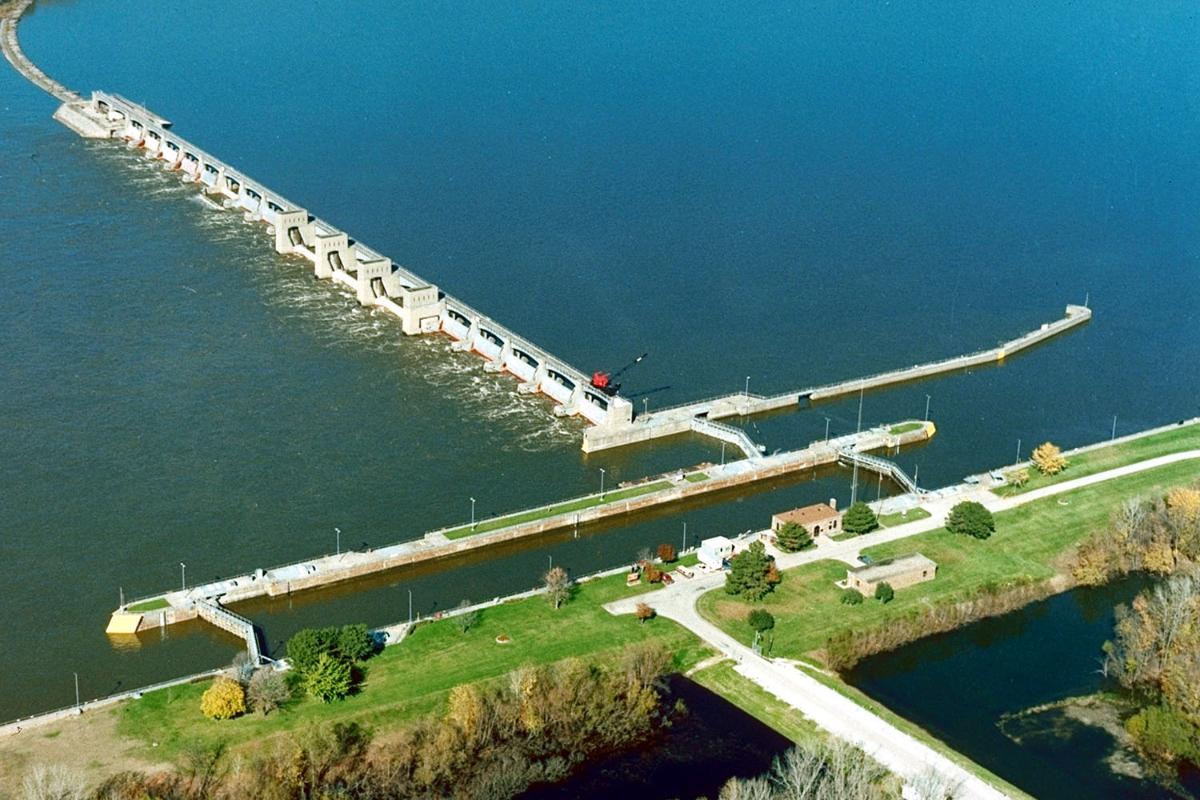
| length of movable section | 411.5 m | |
| lock | width | 33.5 m |
| length | 182.9 m |
Excerpt from Wikipedia
Lock and Dam No. 18 is a lock and dam located near Gladstone, Illinois and Burlington, Iowa on the Upper Mississippi River around river mile 410.5. The movable dam is 1,350 feet (411.5 m) and consists of 3 roller gates and 14 tainter gates. The lock is 110 feet (33.5 m) wide by 600 feet (182.9 m) long. In 2004, the facility was listed in the National Register of Historic Places as Lock and Dam No. 18 Historic District, #04000178 covering 2,049 acres (8.3 km²), 1 building, 4 structures and 4 objects.
Hydroelectric plant
In March 2009, local officials started discussing plans to install a hydroelectric generating plant on the dam.
Text imported from Wikipedia article "Lock and Dam No. 18" and modified on 23 July 2019 under the CC-BY-SA 3.0 license.
Participants
Currently there is no information available about persons or companies having participated in this project.
Relevant Web Sites

- About this
data sheet - Structure-ID
20030593 - Published on:
24/08/2007 - Last updated on:
29/01/2022
Structurae cooperates with


