
General Information
| Completion: | August 1955 |
|---|---|
| Status: | in use |
Project Type
| Structure: |
Through arch bridge Truss arch bridge |
|---|---|
| Support conditions: |
for registered users |
| Function / usage: |
Road bridge |
| Material: |
Steel bridge Structurae Plus/Pro - Subscribe Now! |
Awards and Distinctions
| 1955 |
Honorable Mention
for registered users |
|---|
Location
| Location: |
Jefferson City, Cole County, Missouri, USA |
|---|---|
| Address: | U.S. Route 54 / U.S. Route 63 |
| Crosses: |
|
| Next to: |
Jefferson City Bridge (1991)
|
| Coordinates: | 38° 35' 14.93" N 92° 10' 42.44" W |
Technical Information
Dimensions
| width | 11.5 m | |
| total length | 942.7 m | |
| main bridge | ||
|---|---|---|
| main span | 195.07 m | |
| span lengths | 126.8 m - 195.07 m - 126.8 m | |
| number of spans | 3 | |
Materials
| deck |
steel
|
|---|---|
| piers |
reinforced concrete
|
| truss |
steel
|
Excerpt from Wikipedia
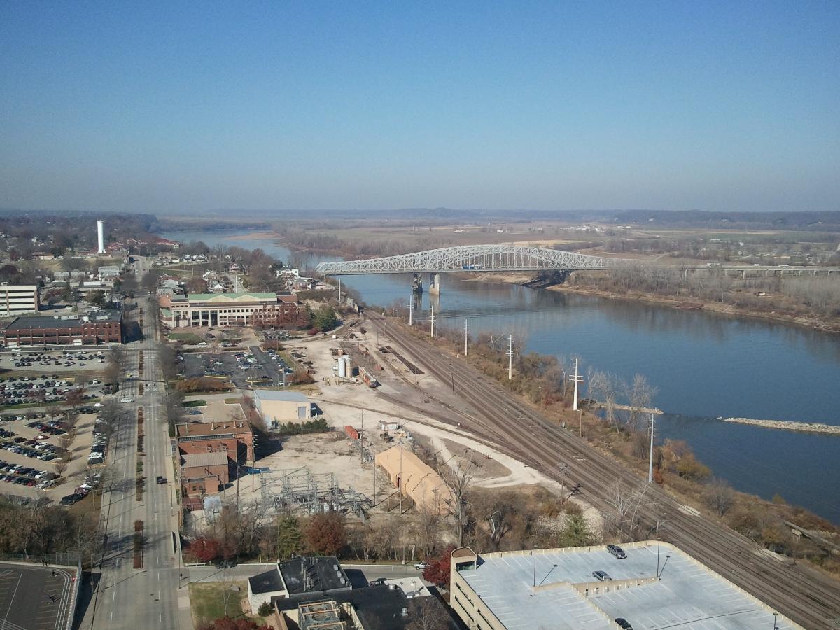
The Jefferson City Bridge is the name for two continuous through arch truss bridges over the Missouri River at Jefferson City, Missouri, over which U.S. Routes 54 (US 54) and 63 travel between Cole and Callaway Counties.
Southbound bridge
The southbound bridge opened in August 1955. Its main span is 195 metres (640 ft) and has a total length of 942.7 metres (3,093 ft) and a deck width of 11.5 metres (38 ft) and vertical clearance of 11.5 metres (38 ft).
Northbound bridge
The northbound bridge opened in 1991. Its main span is 181.5 metres (595 ft) with a total length of 952.3 metres (3,124 ft). The deck width is 14.3 metres (47 ft) and it has vertical clearance of 4.9 metres (16 ft).
The northbound bridge has a cantilevered bicycle and pedestrian lane, opened in April 2011. It is used in both directions for river viewing and access to the Katy Trail State Park. A city-maintained extension of the Katy (following a former KATY railroad spur) connects to the North Jefferson trailhead.
1896 Bridge
The original bridge was built in 1896 and had three spans and was downstream of the current bridge. It had a single column in the middle of the river that rotated 90° to allow boat traffic to pass (the rotation could disrupt traffic for 45 minutes). The bridge was torn down in 1958. The main span was 134.1 metres (440 ft). The diameter of the pivot pier was 6.7 metres (22 ft). The pillars at the south entrance to the bridge are still in place, now a part of Rotary Park, overlooking the river at the end of Bolivar Street.
Text imported from Wikipedia article "Jefferson City Bridge" and modified on 23 July 2019 under the CC-BY-SA 3.0 license.
Participants
Owner
Design
Steel construction

Relevant Web Sites

- About this
data sheet - Structure-ID
20029615 - Published on:
31/07/2007 - Last updated on:
27/03/2021
Structurae cooperates with


