
General Information
| Completion: | 1966 |
|---|---|
| Status: | in use |
Project Type
| Structure: |
Earthfill dam |
|---|---|
| Function / usage: |
Flood barrier Lock |
Location
| Location: |
Somerville, Middlesex County, Massachusetts, USA Everett, Middlesex County, Massachusetts, USA |
|---|---|
| Impounded: |
|
| Coordinates: | 42° 23' 41.57" N 71° 4' 29.76" W |
Technical Information
There currently is no technical data available.
Excerpt from Wikipedia
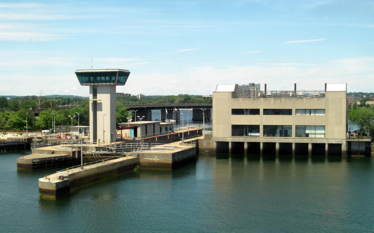
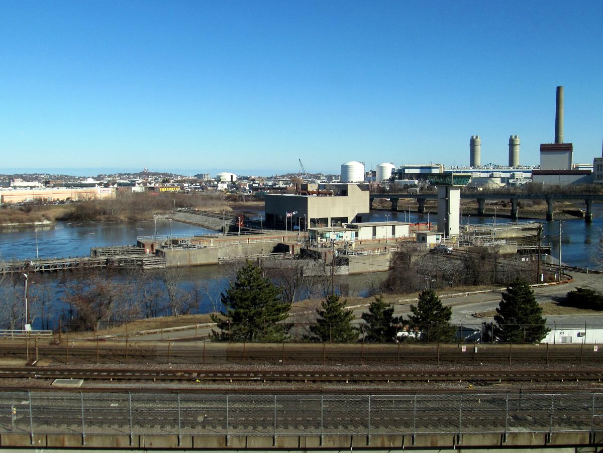
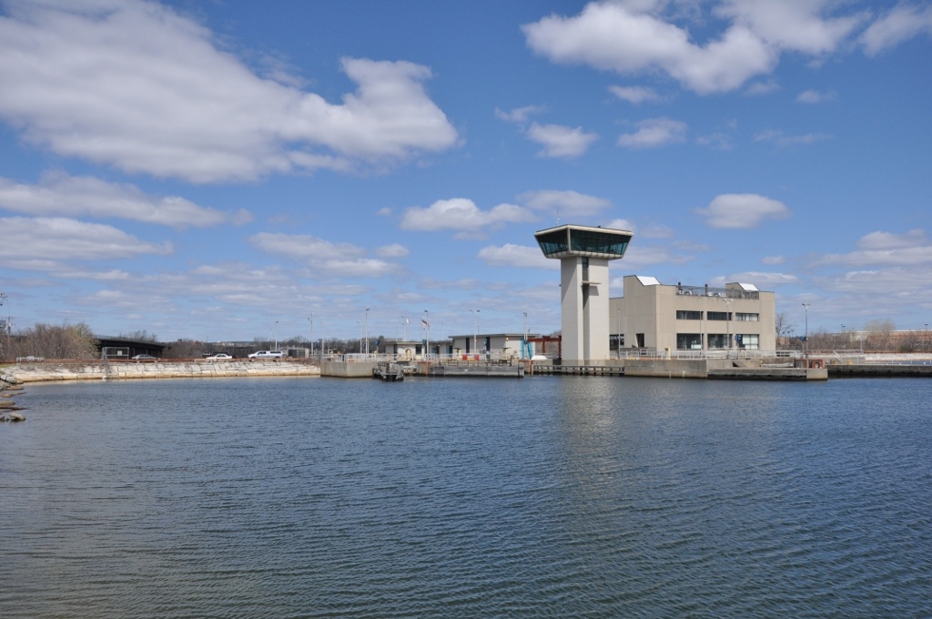
The Amelia Earhart Dam is an earth-fill dam spanning the Mystic River near its mouth between Somerville and Everett, Massachusetts. It was built in 1966 to regulate tidal effects and the incursion of salt water in the upstream river basin. It has 3 locks for marine traffic. The largest is 325 feet long, and 45 feet wide; the two smaller locks are 120 feet long and, 22 feet wide. There is no public access to the dam.
The dam is named after the aviation pioneer Amelia Earhart whose plane disappeared in 1937. Earhart lived in nearby Medford, Massachusetts in the 1920s.
The City of Somerville's 2017 Climate Change Vulnerability Assessment noted that by 2035, a 100-year flood would flank the dam, and by 2070, overtop it, leading to major impacts on low-lying areas such as Assembly Square. In 2018, 21 cities and towns near the Mystic River requested flood prevention and mitigation funding, including approximately $20 million for an additional pump.
Text imported from Wikipedia article "Amelia Earhart Dam" and modified on 11 October 2022 according to the CC-BY-SA 3.0 license.
Participants
Currently there is no information available about persons or companies having participated in this project.
Relevant Web Sites

- About this
data sheet - Structure-ID
20083687 - Published on:
17/09/2022 - Last updated on:
17/09/2022
Structurae cooperates with


