


General Information
Project Type
| Structure: |
Cable-stayed bridge with semi-fan system |
|---|---|
| Secondary structure(s): |
Structurae Plus/Pro - Subscribe Now! Structurae Plus/Pro - Subscribe Now! |
| Function / usage: |
Road bridge Railroad (railway) bridge |
Location
| Location: |
Ciudad Guayana, Bolivar, Venezuela |
|---|---|
| Crosses: |
|
| Coordinates: | 8° 16' 32" N 62° 53' 59" W |
Technical Information
Dimensions
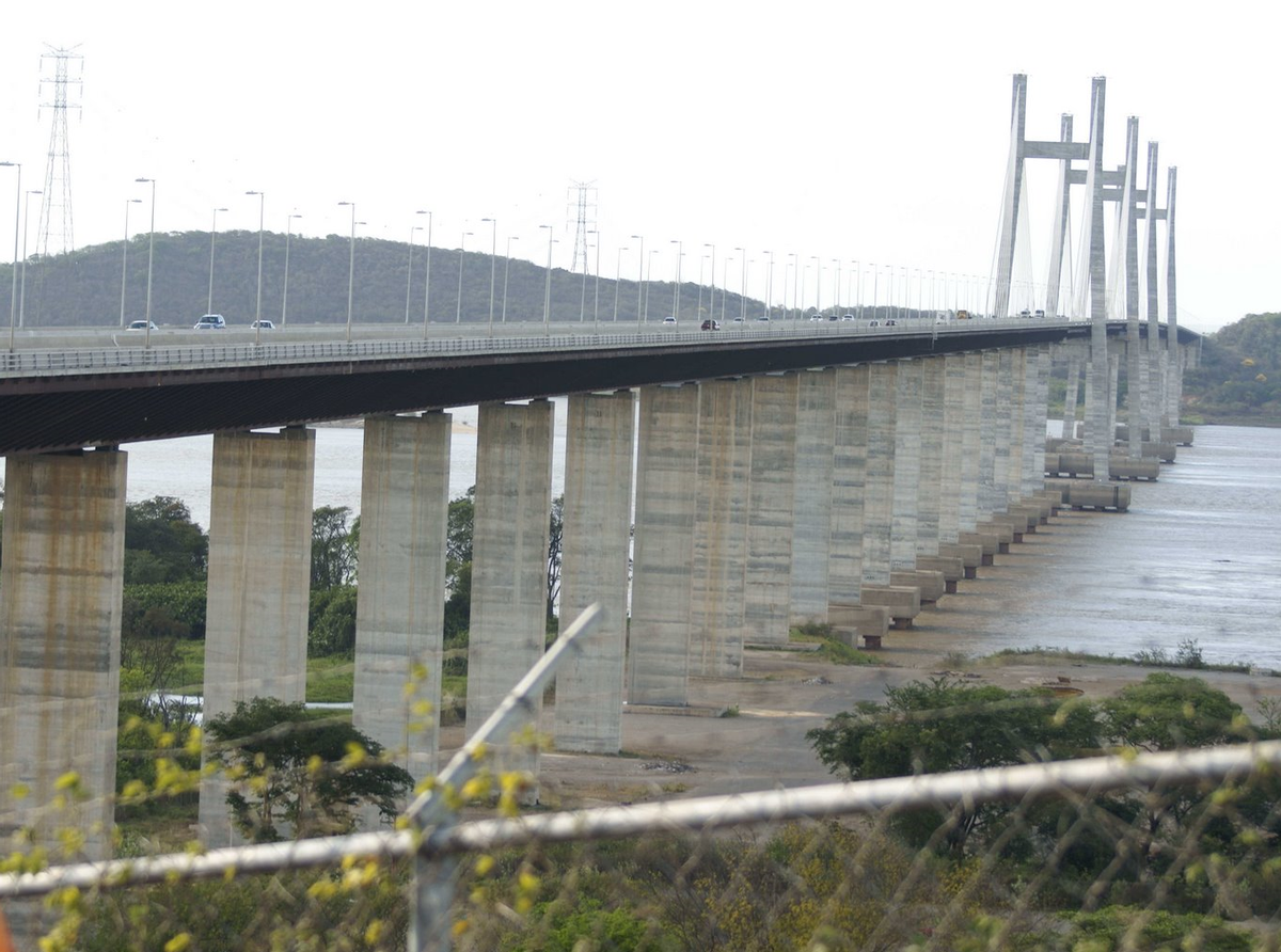
| main span | 300 m | |
| total length | 3 156 m | |
| deck | width | 24.7 m |
| deck depth | 5.33 m | |
| number of tracks | 1 | |
| number of lanes | 2 x 2 | |
| pylon | pylon height | 120 m |
Excerpt from Wikipedia
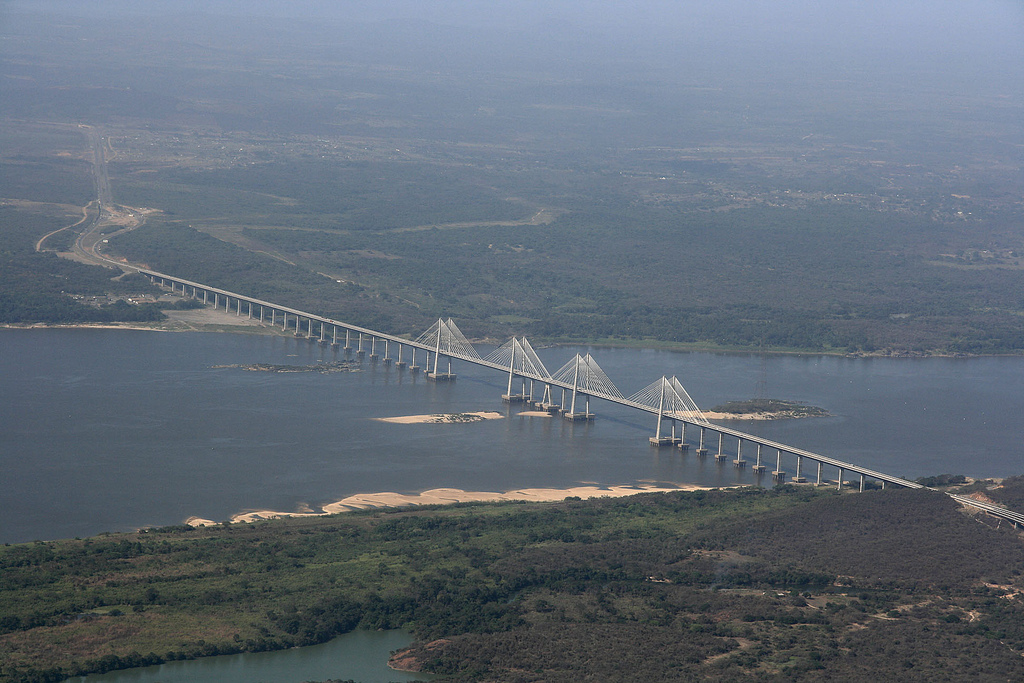
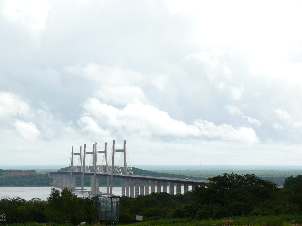
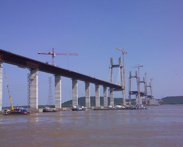
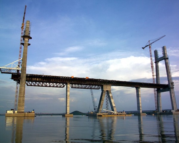
The Second Orinoco crossing or Orinoquia Bridge is a combined road and railway bridge over the Orinoco River near Ciudad Guayana, Venezuela. It was inaugurated on November 13, 2006 and named Orinoquia Bridge. Prior to ist construction, the only crossing of the Orinoco was the Angostura Bridge around 100 km further upstream at Ciudad Bolívar that was opened in 1967.
At the site chosen for the bridge the Orinoco is three kilometres wide with two navigation channels separated by a small island that is revealed during the low water season. The average discharge of the river here varies between 66 000 m³/s and 85 000 m³/s, flowing at up to 2.6 m/s and with a seasonal variation in level of 12.5 m.
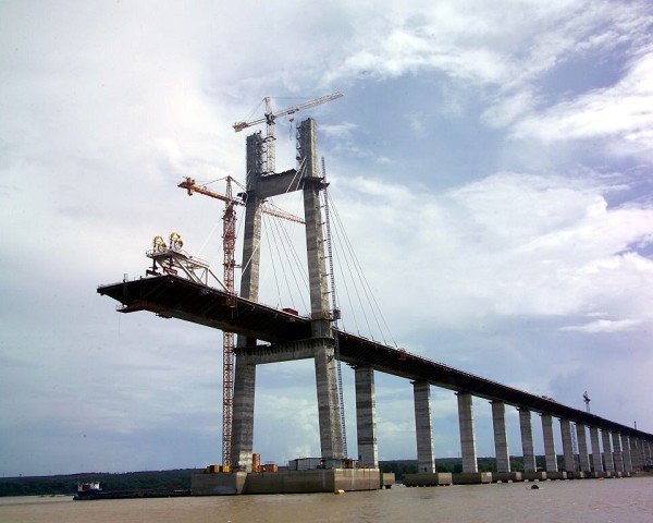
The crossing is composed of approximately 4.5 km of structures and carries four lanes of road traffic separated into two carriageways by a single railway track in the centre. It consists of two cable stayed navigation spans each of 300 m with a south approach 1320 m long composed of 22 60 m spans and a north approach of 636 m composed of ten 60 m spans and one of 36 m. The two navigation spans have a clearance of 41 m above water level and are supported by four 120 m tall H-shaped pylons via two planes of cable stays. Unusually, these spans do not lead directly into each other as at other multi-span cable stayed bridges such as the Millau Viaduct, but are anchored at a fixed point on the mid-stream island.
The bridge was built to complement the existing Angostura Bridge and to provide a more direct connection with the important industrial city of Ciudad Guayana. In particular, it was intended to provide for a future rail connection to allow the city's heavy industrial products to be transported to the ports of Venezuela's Caribbean coast. River transport on the Orinoco includes oceangoing ships, but because of ist high sediment load the Orinoco has to be constantly dredged. In addition the crossing strengthens transport links between Venezuela and Brazil to the South which is important for Brazilian exports. This is one reason why President Lula da Silva of Brazil attended the inauguration together with Venezuela's Hugo Chávez.
Near the bridge, there is Orinoco powerline crossing, whose pylons are the tallest man-made structures in South America today.
Text imported from Wikipedia article "Orinoquia Bridge"
and modified on 03 June 2020 according to the CC-BY-SA 3.0 license.
Participants
Owner
Design
Structural engineering
Consulting engineers
Contractor
Stay cables

Stay cable steel supplier
Prestressing steel
Relevant Web Sites

Relevant Publications
- (2006): Advances in Cable-Supported Bridges. Taylor & Francis, Abingdon-on-Thames (United Kingdom), pp. 261.
- (2007): Cable-stayed Bridges across the Panama Canal and the Orinoco. Presented at: IABSE Symposium: Improving Infrastructure Worldwide, Weimar, Germany, 19-21 September 2007, pp. 56-57.
- Freyssinet cable-stayed structures. Freyssinet International, Vélizy-Villacoublay (France), 2004, pp. 78.
- (2006): Die Orinoco-Brücke in Ciudad Guayana/Venezuela - Doppel-Schrägkabelbrücke mit Verbundüberbau für Straßen- und Eisenbahngüterverkehr. In: Stahlbau, v. 75, n. 2 (February 2006), pp. 82-92.
- Un second pont sur un fleuve géant. In: Sols et Structures, n. 223 (First semester 2006), pp. 16-17.
- About this
data sheet - Structure-ID
20010507 - Published on:
18/10/2003 - Last updated on:
01/03/2020
Structurae cooperates with


