
General Information
Project Type
| Structure: |
Three-span cable-stayed bridge |
|---|---|
| Function / usage: |
Road bridge |
| Material: |
Steel-reinforced concrete composite bridge |
Location
| Location: |
Khartoum, Sudan Khartoum North, Sudan |
|---|---|
| Address: | El Mek Nimir Street |
| Crosses: |
|
| Coordinates: | 15° 36' 50" N 32° 31' 58" E |
Technical Information
Dimensions
| deck | deck width | 22 m |
| roadway / carriageway width | 2 x 2 × 3.625 m | |
| walkway width | 2 x 1.50 m | |
| approach viaducts | ||
|---|---|---|
| total length | 523 m | |
| main bridge | ||
| total length | 642.50 m | |
| span lengths | 32.5 m - 2 x 40 m - 3 x 50 m - 55 m - 80 m - 55 m - 3 x 50 - 40 m | |
| number of spans | 10 | |
Materials
| deck |
composite steel-reinforced concrete
|
|---|---|
| approach viaducts |
reinforced earth
|
Chronology
| 16 August 2005 | Groundbreaking ceremony. |
|---|---|
|
31 January 2006
— 14 June 2006 |
Construction of the piles. |
|
7 March 2006
— 25 July 2006 |
Construction of the piers. |
|
1 August 2006
— 9 April 2007 |
Duration of the steel works. |
| 23 April 2007 | Construction of the deck slab begins. |
Excerpt from Wikipedia
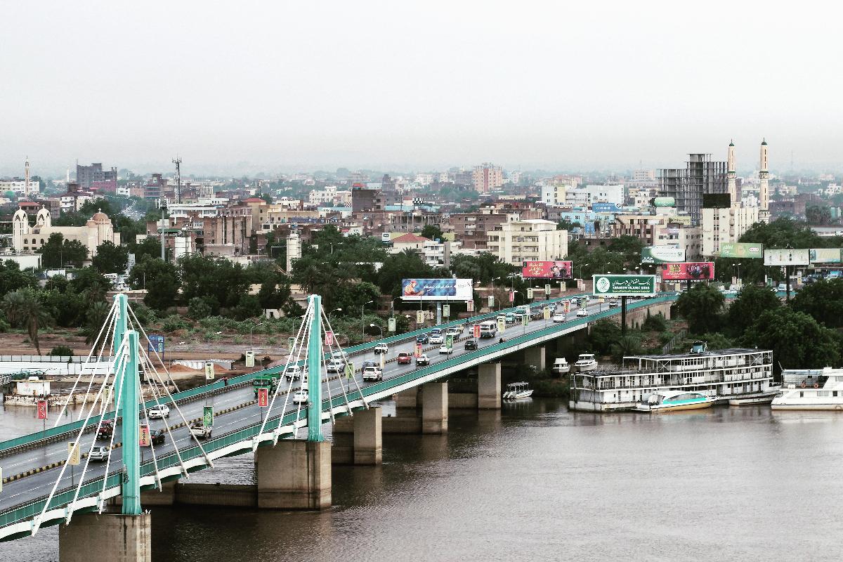
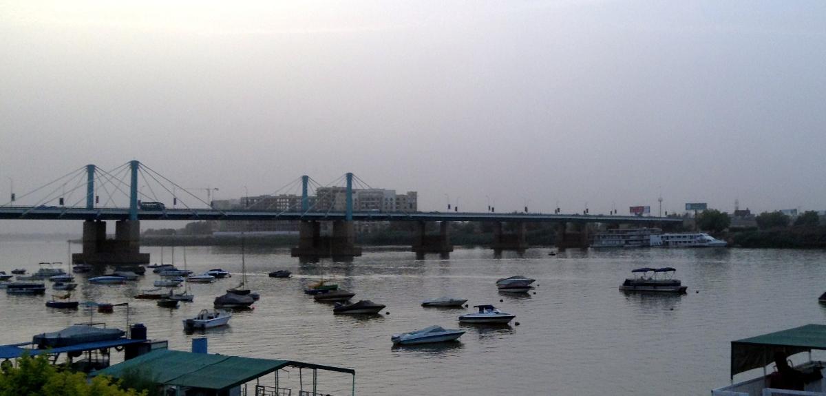
Opened in 2007, the El Mek Nimr Bridge links the downtown area of Khartoum, Sudan with the adjacent city of Khartoum North across the Blue Nile river. It is named after a famous leader of the Jaaliyeen tribe in Northern Sudan, who infamously burned the son of Muhammad Ali Pasha, Ismail, and his cortege when they invaded Sudan from Egypt in 1822.
Text imported from Wikipedia article "El Mek Nimr Bridge"
and modified on 03 June 2020 according to the CC-BY-SA 3.0 license.
Participants
Relevant Web Sites


- About this
data sheet - Structure-ID
20020072 - Published on:
17/03/2006 - Last updated on:
25/11/2022
Structurae cooperates with


