
General Information
| Completion: | 26 December 1839 |
|---|---|
| Status: | destroyed (1852) |
Project Type
| Structure: |
Single-span two-tower suspension bridge |
|---|---|
| Function / usage: |
Road bridge |
| Material: |
Structurae Plus/Pro - Subscribe Now! Structurae Plus/Pro - Subscribe Now! |
Location
| Location: |
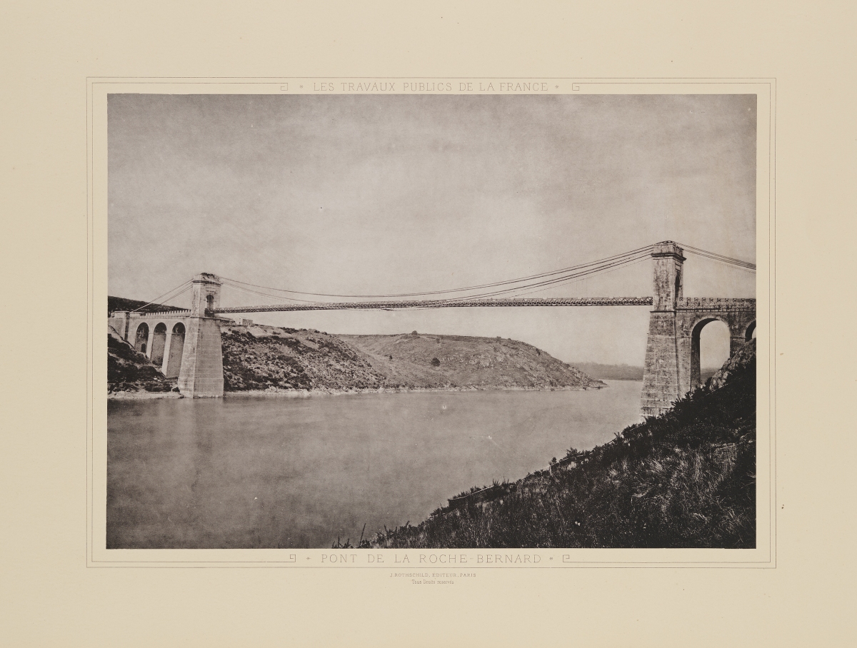
La Roche-Bernard, Morbihan (56), Bretagne, France |
|---|---|
| Crossed: |
|
| Replaced by: |
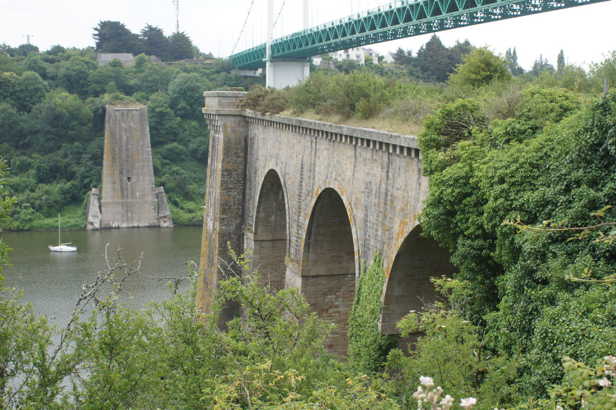
La Roche-Bernard Bridge (1911)
|
| Coordinates: | 47° 31' 28" N 2° 18' 13" W |
| Coordinates: | 47° 31' 31" N 2° 18' 22" W |
Technical Information
Dimensions
| main span | 198 m | |
| width | 7 m | |
| total length | 360 m |
Cost
| cost of construction | French Franc 1 127 000 |
Materials
| approach viaducts |
masonry
|
|---|---|
| pylons |
masonry
|
| deck flooring |
wood
|
Chronology
| 26 October 1852 | The deck collapses into the river in a storm. The bridge is reconstructed in identical fashion. Other destructions occur in 1866, 1869, 1870 and 1871. |
|---|---|
| 1872 | A temporary footbridge is built 1.60 meters above the deck with a width of 3 m. It lasts 40 years the entire bridge is replaced in 1911. |
Notes
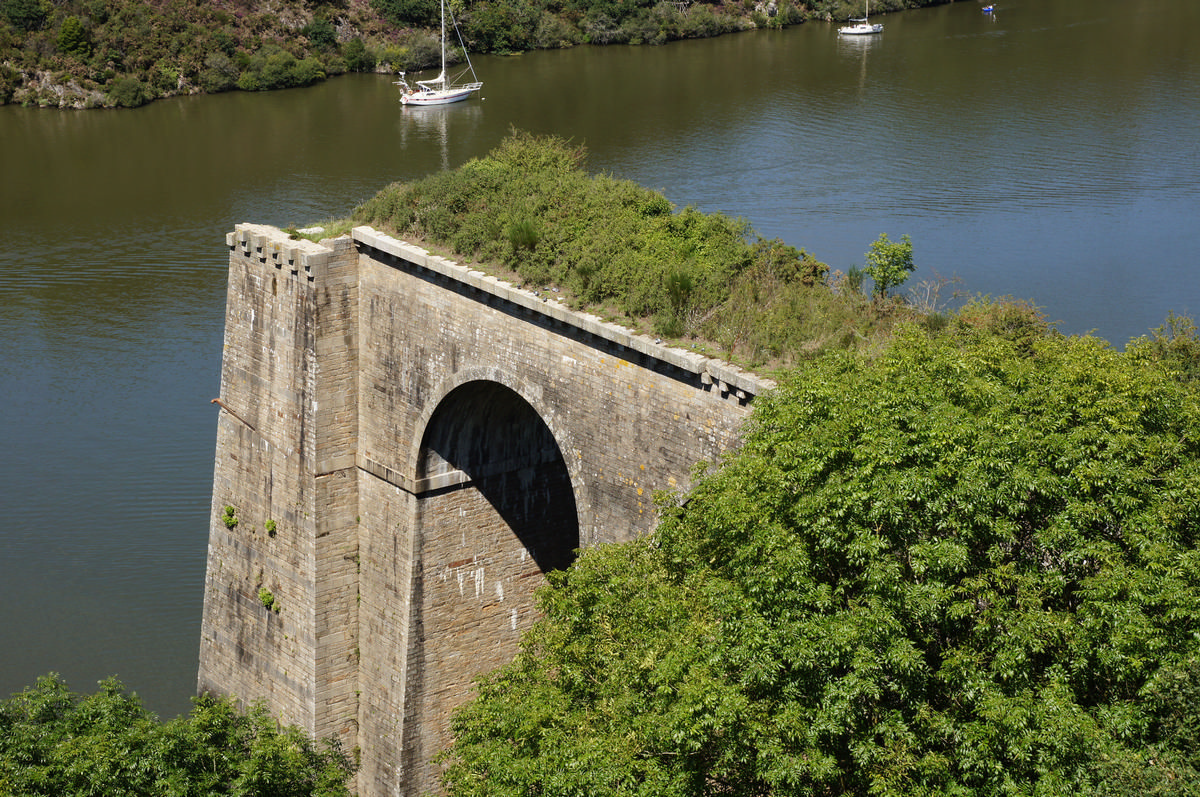
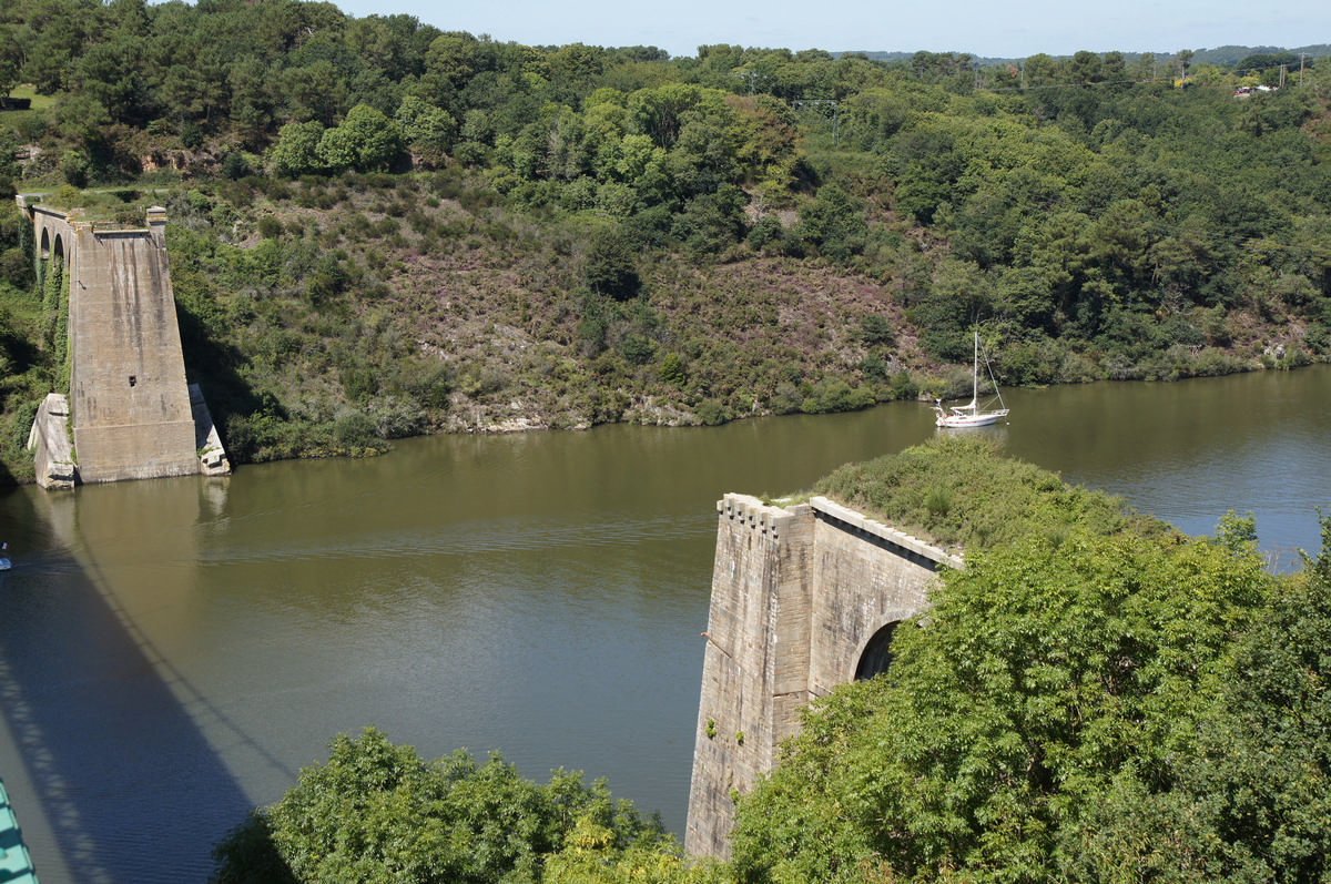
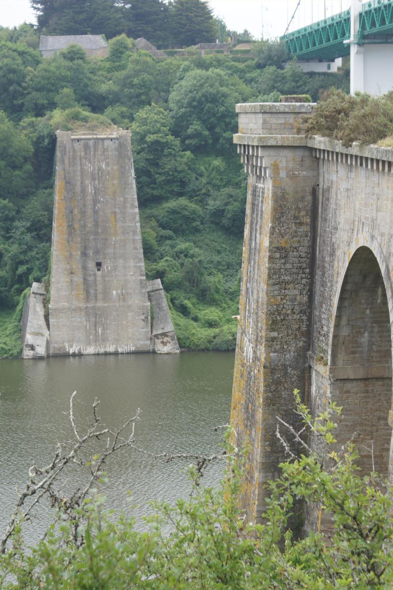
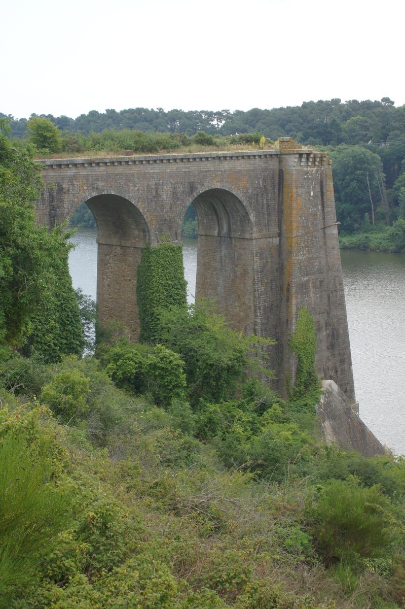
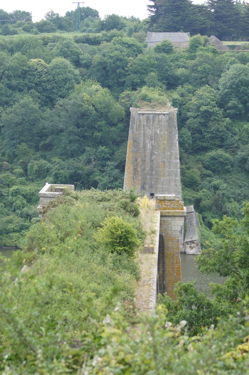
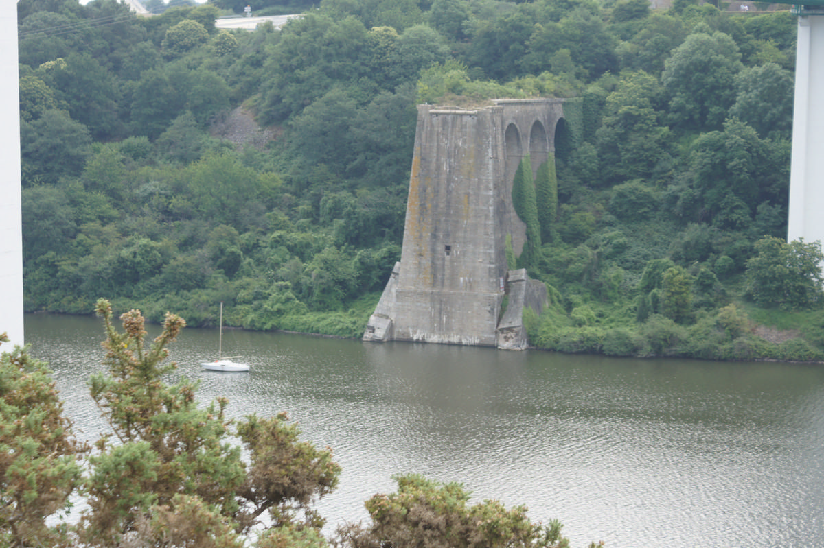
The approach piers still remain.
Participants
Engineering
- P. Leblanc (engineer)
Relevant Web Sites
There currently are no relevant websites listed.
Relevant Publications
- (1986): L'architecture du fer. France: XIXe siècle. Editions Champ Vallon, Seyssel (France), ISBN 9782903528713, pp. 124.
- (1840): Description du pont suspendu de la Roche-Bernard. Paris (France).
- (1988): Ponts et viaducs au XIXème siècle. Poitiers (France), pp. 266-267.
- (1999): Tierra sobre el agua. Visión histórica universal de los puentes. Colegio de Ingenieros de Caminos, Canales y Puertos, Madrid (Spain), pp. 86.
- (1891): Traité des Ponts [Deuxième partie, Tome 2]. Ponts en charpents, métalliques et suspendus. Fanchon et Artus éditeurs, Paris (France), pp. 57-67.
- About this
data sheet - Structure-ID
20004742 - Published on:
30/08/2002 - Last updated on:
24/06/2022
Structurae cooperates with


