
General Information
| Completion: | 1272 |
|---|---|
| Status: | in use |
Project Type
| Structure: |
Vaulted arch bridge |
|---|---|
| Function / usage: |
original use: Road bridge current use: Pedestrian bridge (footbridge) |
| Material: |
Masonry bridge |
Location
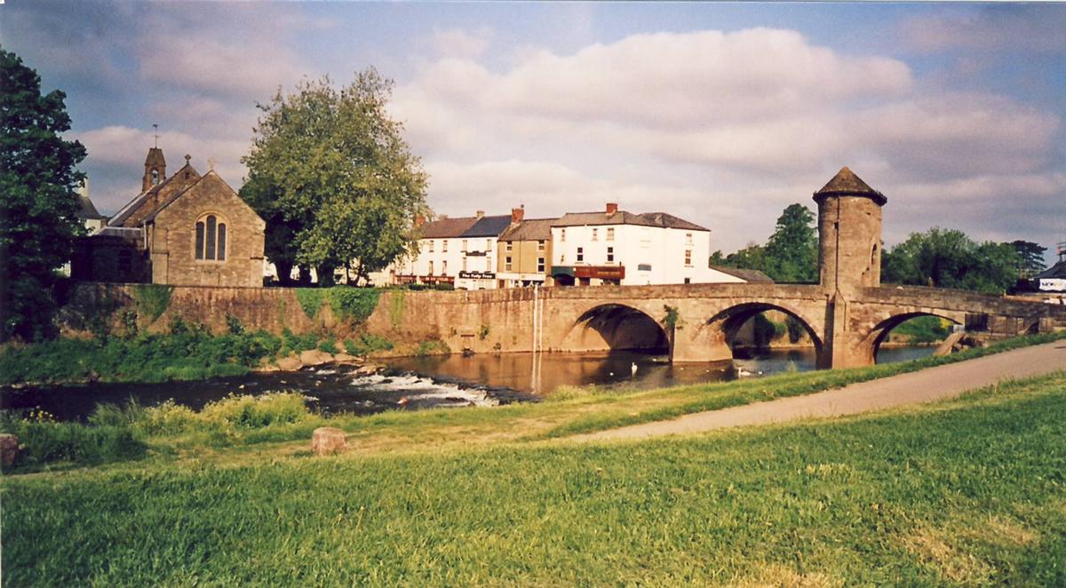
| Location: |
Monmouth, Monmouthshire, Wales, United Kingdom |
|---|---|
| Crosses: |
|
| Coordinates: | 51° 48' 32.39" N 2° 43' 12.14" W |
Technical Information
Dimensions
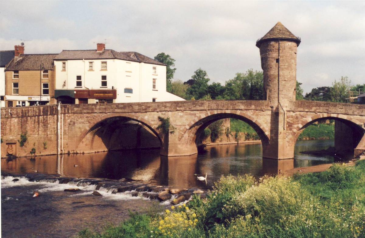
| total length | 34.80 m | |
| deck | deck width | 7.30 m |
Materials
| arches |
stone
|
|---|
Chronology
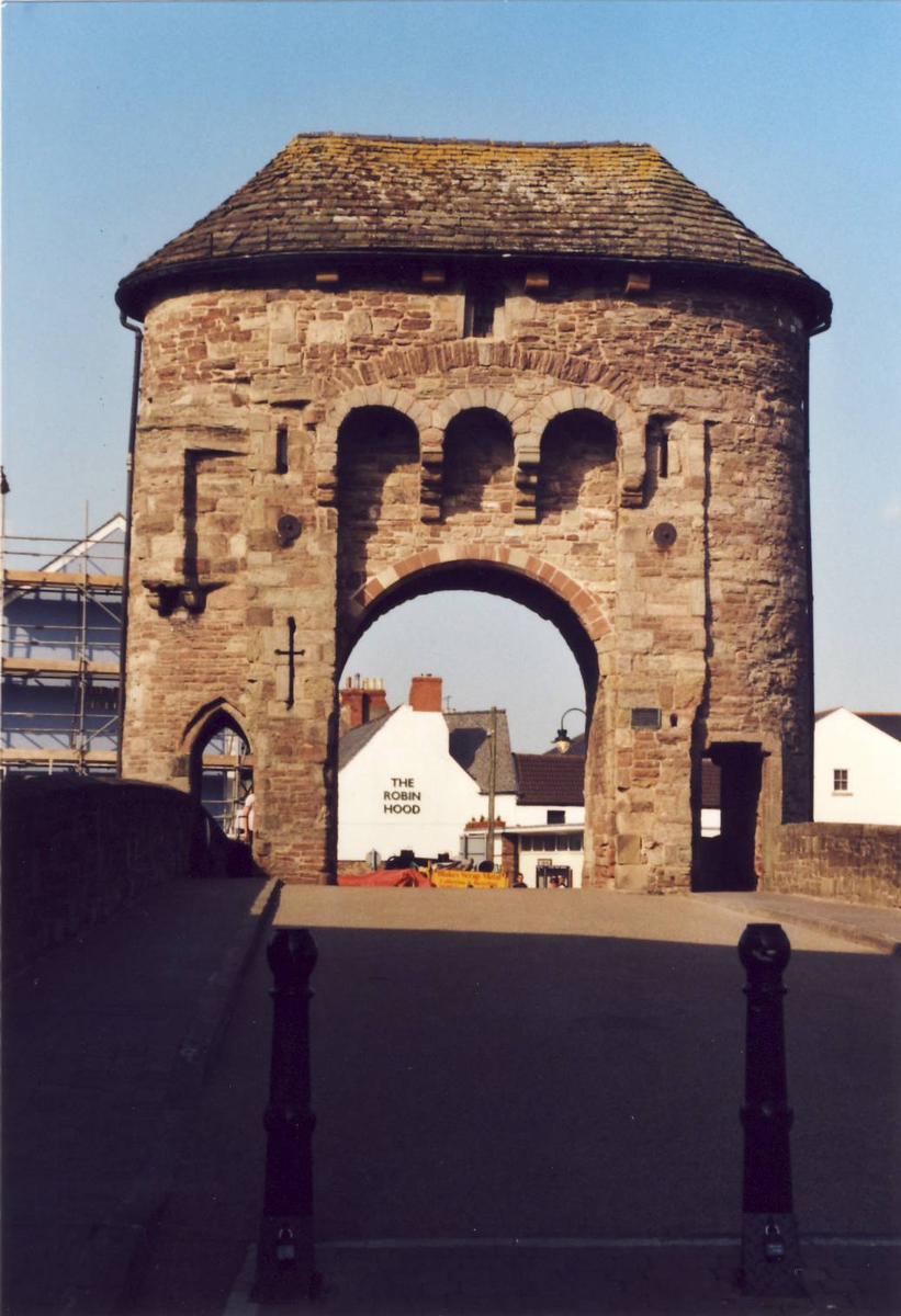
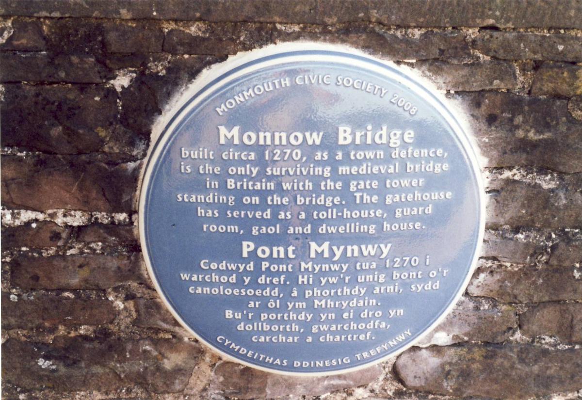
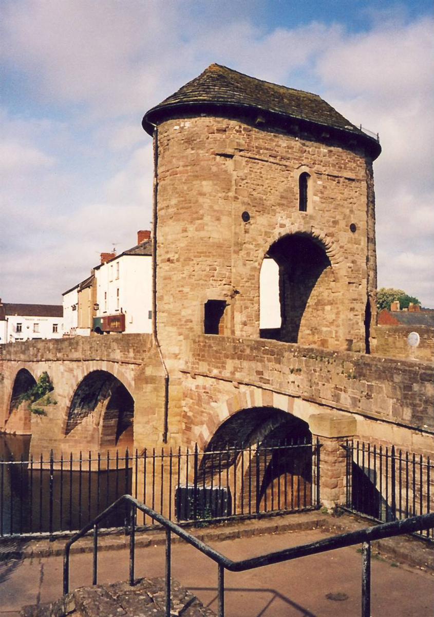
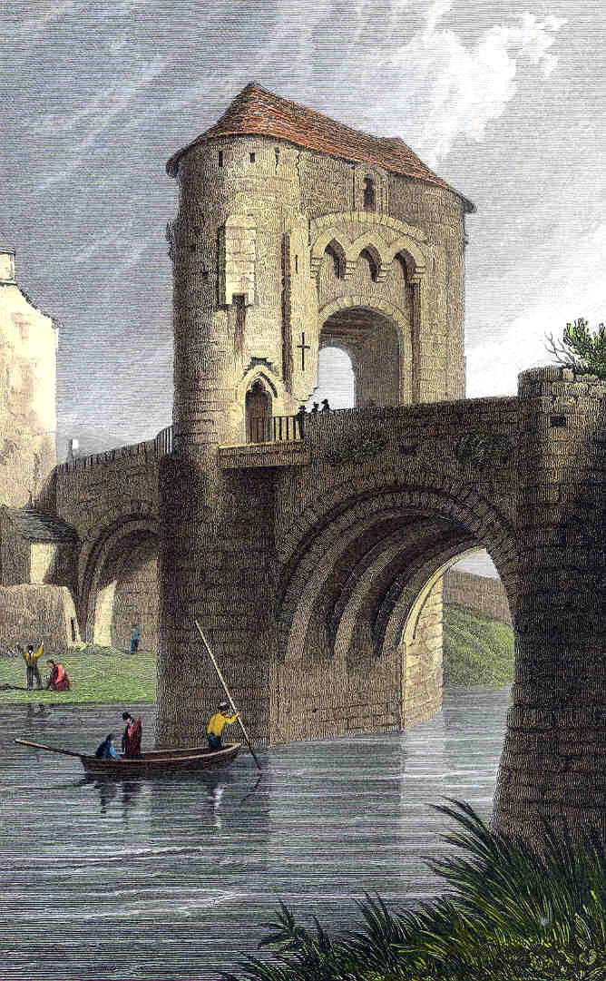
| ca. 1272 | Bridge is built. |
|---|---|
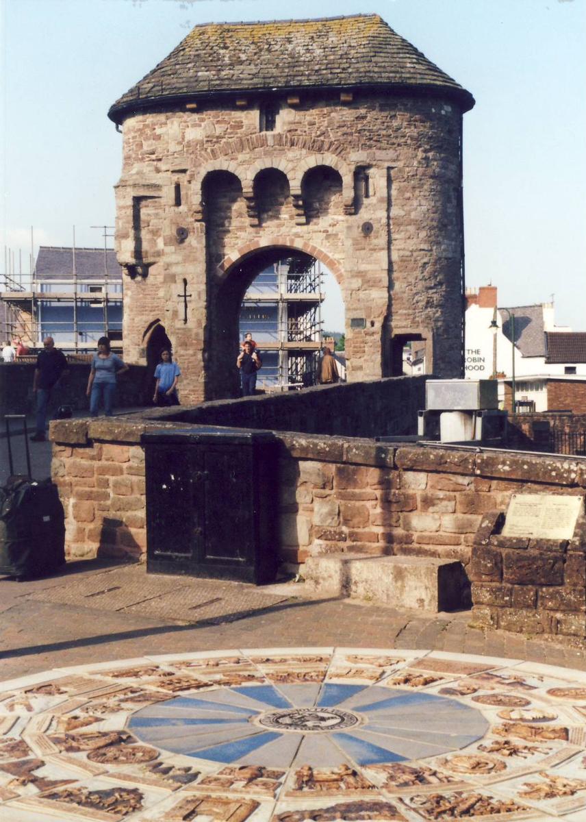
| ca. 1297 | Addition of the Monnow Gate. |
| 1705 | The Monnow Gate is converted into a dwelling. |
| 1827 — And 1830 | The bridge is widened. |
| 1989 | Strengthening works to pier foundations. |
| 1989 | Remains of previous wooden bridge dated to circa 1135-1169 discovered in river bed directly under Monnow Bridge. |
| March 2004 | With the opening of the New Monnow Bridge, the old bridge is closed to vehicular traffic and is now only accessible to pedestrians. |
Participants
Relevant Web Sites
There currently are no relevant websites listed.
Relevant Publications
- (1990): Les grands ponts du monde: Ponts remarquables d'Europe. Brissaud, Poitiers (France), pp. 261.
- (1994): Monnow Bridge and Gate. Alan Sutton Publishing, Stroud (United Kingdom).
- About this
data sheet - Structure-ID
20007217 - Published on:
11/12/2002 - Last updated on:
28/05/2021
Structurae cooperates with


