
Sendemasten Marinefunkstelle Saterland-Ramsloh
General Information
Project Type
| Structure: |
Cable-stayed steel tube mast |
|---|---|
| Function / usage: |
Long wave transmitter |
| Material: |
Steel tower or mast |
Location
| Location: |
Saterland, Cloppenburg (Kreis), Lower Saxony, Germany |
|---|---|
| Coordinates: | 53° 5' 0.02" N 7° 37' 9.70" E |
| Coordinates: | 53° 4' 52.13" N 7° 36' 34.63" E |
| Coordinates: | 53° 5' 14.36" N 7° 36' 31.07" E |
| Coordinates: | 53° 5' 22.06" N 7° 37' 6.45" E |
| Coordinates: | 53° 4' 36.31" N 7° 36' 58.73" E |
| Coordinates: | 53° 4' 30.23" N 7° 36' 22.81" E |
| Coordinates: | 53° 4' 17" N 7° 37' 17.42" E |
| Coordinates: | 53° 4' 10.83" N 7° 36' 41.97" E |
Technical Information
Dimensions
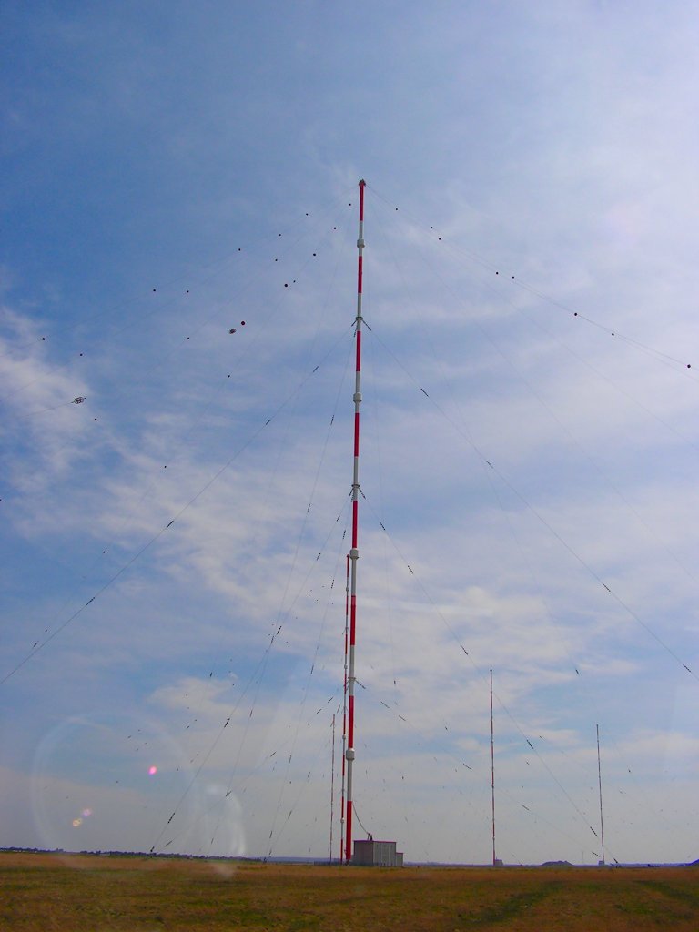
| height | 352.8 m |
Materials
| shaft |
steel tubes
|
|---|
Excerpt from Wikipedia
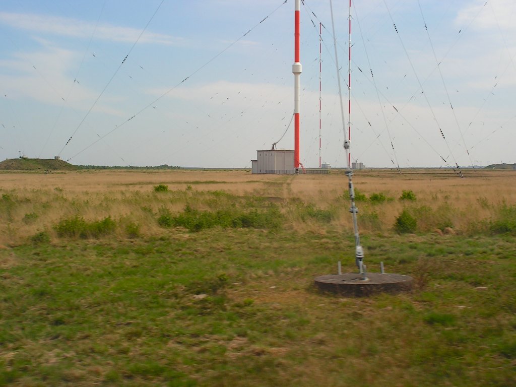
The VLF transmitter DHO38 is a VLF transmitter used by the German Navy near Rhauderfehn, Saterland, Germany. It is used to transmit coded orders to submarines of the German Navy and navies of other NATO countries.
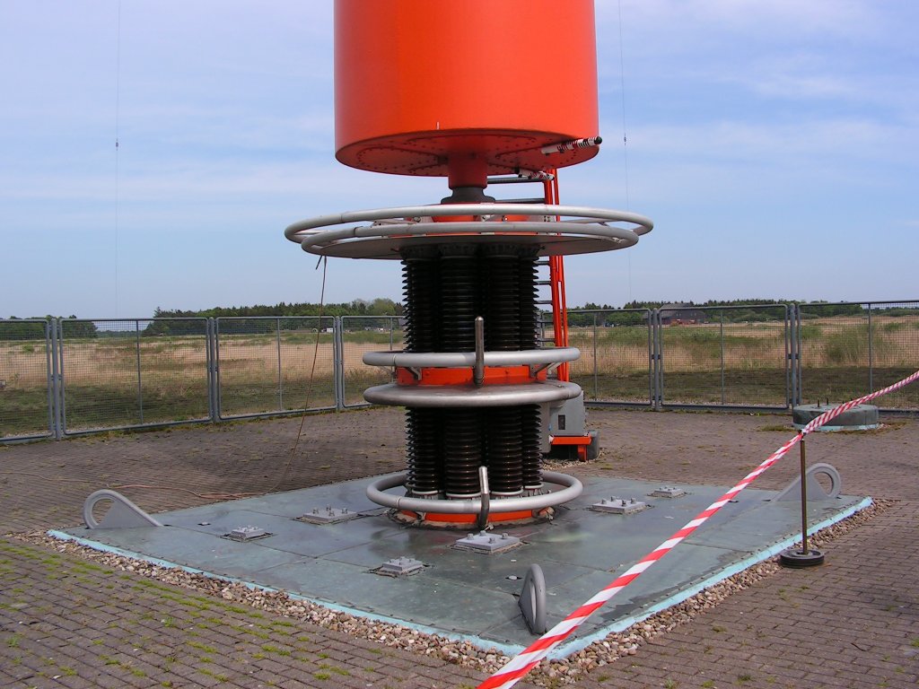
DHO38 has transmitted since 1982 on 23.4 kHz with a power of up to 800 kilowatts. DHO38 uses an umbrella antenna which is carried from 8 steel tube masts with a height of 352.8 metres. Each pylon stands on 3 metre tall ceramic cylinders, which serve as insulators for voltages up to 300 kV. The masts are equipped with cylindrical oscillation dampers for better protection against storms. The transmitter is capable of transmitting signals to submarines worldwide to depths of approx. 30 metres.
Text imported from Wikipedia article "VLF transmitter DHO38" and modified on 23 July 2019 under the CC-BY-SA 3.0 license.
Participants
Currently there is no information available about persons or companies having participated in this project.
Relevant Web Sites

Relevant Publications
- : Langwellen- und Längstwellenfunk. Siebel-Verlag.
- About this
data sheet - Structure-ID
20012017 - Published on:
09/05/2004 - Last updated on:
16/05/2015
Structurae cooperates with


