
General Information
| Name in local language: | Phare de Ploumanac'h |
|---|---|
| Completion: | 1945 |
| Status: | in use |
Project Type
| Function / usage: |
Lighthouse |
|---|---|
| Material: |
Concrete tower |
Location
| Location: |
Ploumanac'h, Perros-Guirec, Côtes-d'Armor (22), Bretagne, France |
|---|---|
| Coordinates: | 48° 50' 14.97" N 3° 29' 0.21" W |
Technical Information
Dimensions
| height | 15 m |
Excerpt from Wikipedia
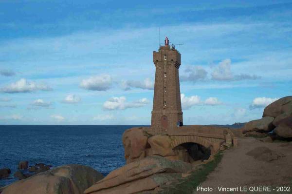
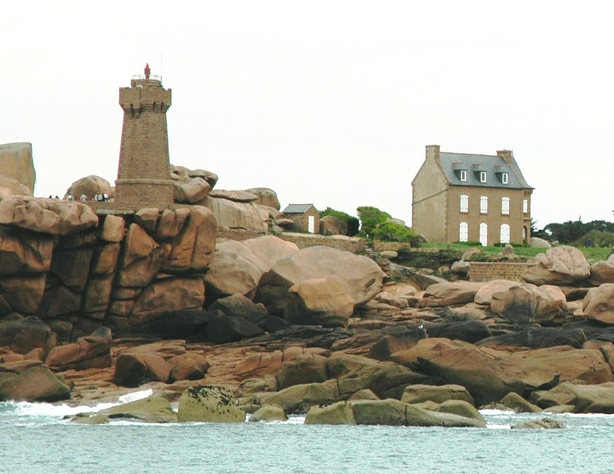
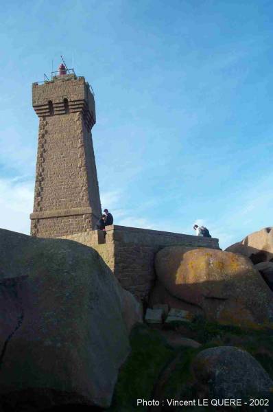
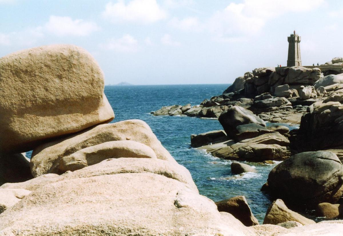
The Ploumanac'h Lighthouse (officially the Mean Ruz Lighthouse) is an active lighthouse in Côtes-d'Armor, France, located in Perros-Guirec. The lighthouse is closed to the public.
The structure is composed of pink granite, and marks the entrance to the channel leading to the port of Ploumanac'h.
History
The first Ploumanac'h Lighthouse dates from 1860. This was destroyed by German troops on August 4, 1944, and replaced by the current lighthouse in 1946. The present-day version was planned by architect Henry Auffret, and built by Martin et frère (a local construction company).
The lighthouse offers a direct view of Château de Costaérès, l'île Renote and Jentilez.
Etymology
The lighthouse gets ist common name from the nearby town of Ploumanac'h, meaning "monk's pool" in Breton. The official name of "Mean Ruz" comes from the Breton cacographic phrase Maen Ruz, meaning "red stone".
Text imported from Wikipedia article "Ploumanac'h Lighthouse" and modified on 21 February 2022 according to the CC-BY-SA 3.0 license.
Participants
Currently there is no information available about persons or companies having participated in this project.
Relevant Web Sites

- About this
data sheet - Structure-ID
20009002 - Published on:
15/04/2003 - Last updated on:
14/12/2016
Structurae cooperates with


